


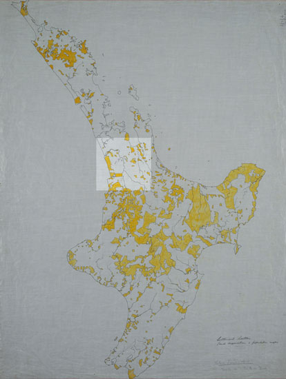
This map from the centennial historical atlas series shows in yellow the land owned by Māori in 1910. It is evident that even at this stage, over 40 years after the land confiscations, very little of the Waikato area was in Māori ownership. The confiscations (known as Te Raupatu-o-Waikato) condemned the Waikato people to destitution for over a century.
Using this item
Alexander Turnbull Library, Centennial Historical Atlas Collection
Reference:
MapColl-CHA-6/2/6-Acc.38315
Permission of the Alexander Turnbull Library, National Library of New Zealand, Te Puna Mātauranga o Aotearoa, must be obtained before any re-use of this image.


Add new comment