


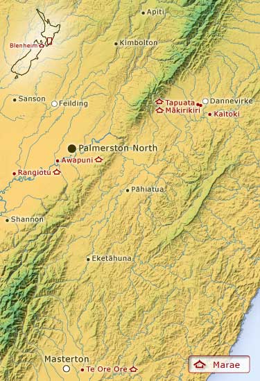
This map shows the location of Rangitāne marae in the Manawatū and Wairarapa districts, and near Dannevirke. There is also a marae in Blenheim, shown at top left. The scattered nature of these marae reflects the wide area settled by the tribe.
Using this item
Te Ara - The Encyclopedia of New Zealand
This item has been provided for private study purposes (such as school projects, family and local history research) and any published reproduction (print or electronic) may infringe copyright law. It is the responsibility of the user of any material to obtain clearance from the copyright holder.
Add new comment