


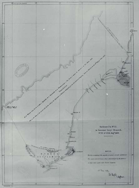
This map shows the boundaries of the large region, including Canterbury, purchased by the Crown from the Ngāi Tahu people in 1848. The Otago block and Banks Peninsula were separate purchases. Discussions began when Governor George Grey and Colonel William Wakefield of the New Zealand Company met Ngāi Tahu chiefs at Akaroa. Later, Henry Tacy Kemp was sent to negotiate the details of the purchase. Boundaries and reserves for Ngāi Tahu were agreed, but many of the reserves were later reduced or ignored, and the northern and western boundaries of the purchase were disputed.
Using this item
This item has been provided for private study purposes (such as school projects, family and local history research) and any published reproduction (print or electronic) may infringe copyright law. It is the responsibility of the user of any material to obtain clearance from the copyright holder.


Add new comment