


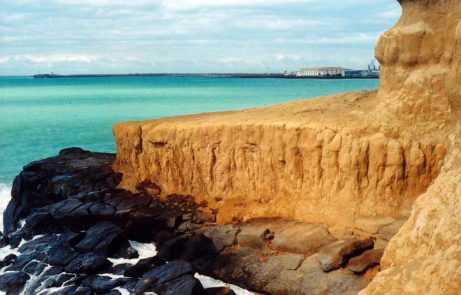
Deposits of loess – wind-blown dust – are common in the South Island. Most areas of loess were formed in glacial periods when there was little vegetation. This exposure on the coast at Dashing Rocks, Timaru, contains thick layers of loess separated by darker soils. The loess accumulated in periods of cold climate, and the soils formed in warmer, interglacial periods.
It was from Dashing Rocks, in 1891, that amateur geologist John Hardcastle recognised that loess is an indicator of past glacial climates, many years before this was accepted elsewhere in the world.
Using this item
Private collection
Photograph by Simon Nathan
This item has been provided for private study purposes (such as school projects, family and local history research) and any published reproduction (print or electronic) may infringe copyright law. It is the responsibility of the user of any material to obtain clearance from the copyright holder.

Add new comment