


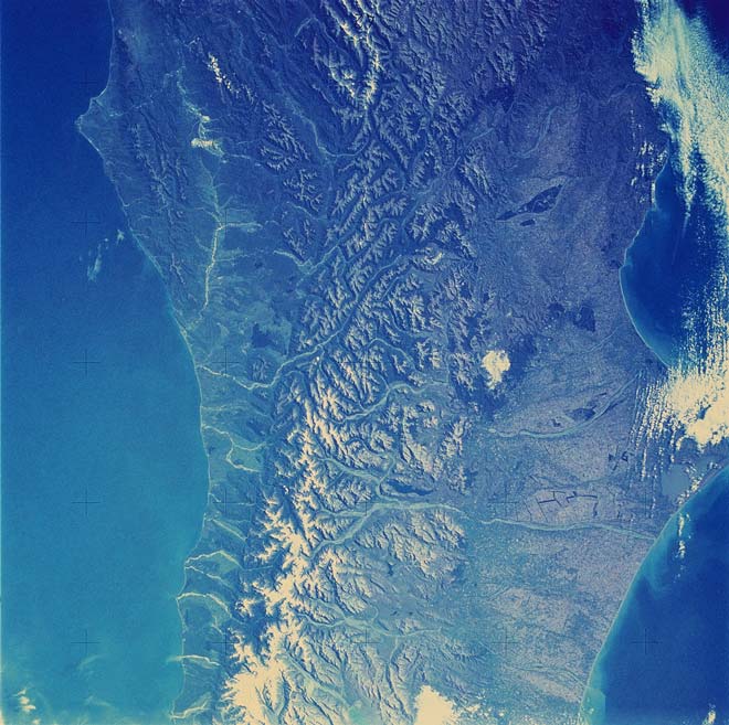
This satellite image shows the snow-covered Southern Alps in the central part of the South Island, cut off by the Alpine Fault on the western (left) side. Rivers flowing away from the mountains carry a big load of gravel and sand. On the eastern (right) side of the mountains the major rivers have formed several large alluvial fans that have combined to form the Canterbury Plains – one of the largest areas of agricultural land in New Zealand.
Using this item
NASA - JSC Digital Image Collection
Reference:
SL4-137-3700
This item has been provided for private study purposes (such as school projects, family and local history research) and any published reproduction (print or electronic) may infringe copyright law. It is the responsibility of the user of any material to obtain clearance from the copyright holder.
Add new comment