


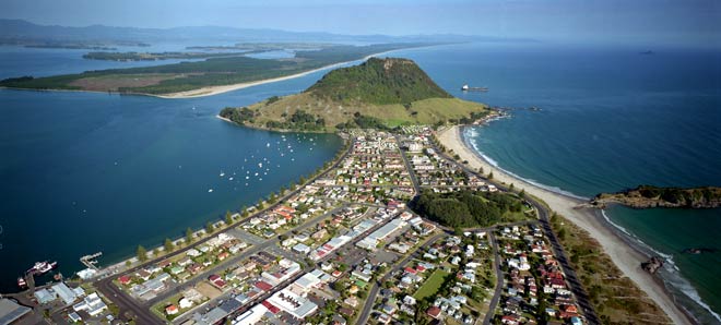
Mt Maunganui (Mauao), at the entrance to Tauranga Harbour, is a large lava dome formed by the upwelling of rhyolite lava about two to three million years ago. The urban area in the foreground occupies a narrow neck of dune sand – called a tombolo – that linked Mt Maunganui to the mainland several thousand years ago after sea level rose to its present height.
Using this item
GNS Science
Reference:
CN30758
Photograph by Lloyd Homer
Permission of GNS Science must be obtained before any use of this image.

Add new comment