


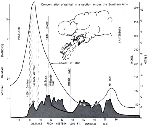
This cross-section shows the wide variation in annual rainfall within a few tens of kilometres on the western side of the Southern Alps. The highest rainfall – over 10 metres – occurs in a narrow band where the prevailing westerly winds force moist air from the Tasman Sea over the mountains. As the air rises and cools, it drops much of the moisture as rain.
Using this item
Private collection
Graphic by Trevor Chinn
This item has been provided for private study purposes (such as school projects, family and local history research) and any published reproduction (print or electronic) may infringe copyright law. It is the responsibility of the user of any material to obtain clearance from the copyright holder.
Source: Trevor Chinn, ‘How wet is the wettest of the wet West Coast’. New Zealand Alpine Journal 32 (1979): 86

Add new comment