


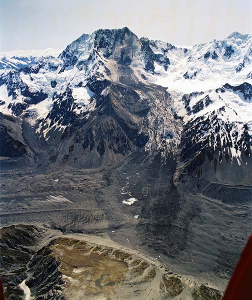
In the early morning of 14 December 1991, 12 million cubic metres of Aoraki/Mt Cook, in the Southern Alps, collapsed and roared down the ice fields of the east face. It then plunged to the Tasman Glacier on the valley floor. The rock avalanche travelled 7.5 kilometres at an average speed of 200 kilometres an hour. No property was damaged and there were no fatalities, but climbers on the mountain had a close call. The edge of the slide passed less than 300 metres from Plateau Hut as they were readying themselves for an attempt on the summit.
Using this item
GNS Science
Reference:
CN21418/12
Photograph by Lloyd Homer
Permission of GNS Science must be obtained before any use of this image.

Add new comment